What if your morning walk ended at the water’s edge? If you’re drawn to Fairfield’s shoreline, you’re likely weighing the lifestyle, costs, and trade-offs of living near Jennings and Penfield. This guide breaks down beach neighborhoods, housing, schools, commute options, and what daily life really feels like in season and off season. Let’s dive in.
Beach neighborhoods at a glance
Fairfield offers roughly five miles of Long Island Sound shoreline and five public beaches, all open to the public with seasonal services and parking controls. You’ll hear the most about Jennings Beach and Penfield Beach. Jennings is the town’s largest beach at about 27 acres, while Penfield is smaller at about 3.5 acres. Both have seasonal lifeguards, concessions, and restrooms, which shapes a very active summer scene for nearby homes. You can explore the town’s beach lineup on the official page for Fairfield’s public beaches.
Day-to-day life also revolves around nearby amenities. You’ll find the Henry Rowland Memorial Playground and skate park by Jennings, the town’s South Benson marina for boating, and a private beach club between Jennings and Penfield. Larger programmed events and holiday fireworks often focus around the main beaches, which can boost crowds and traffic on peak days.
Homes and the Sandy rebuild
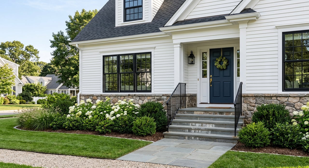
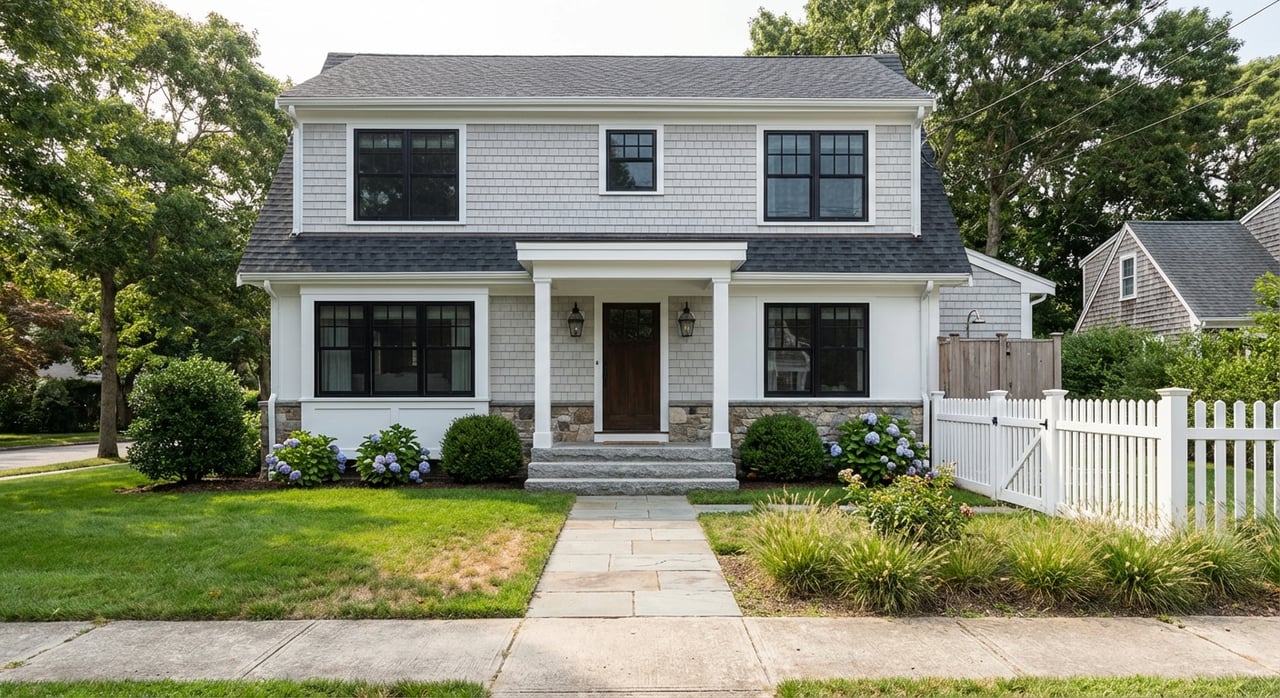
The beach streets once featured many modest mid-century cottages, capes, and ranches. Over the past decade, a wave of renovations and new builds added larger Colonial, Craftsman, and shingle-style homes on smaller lots. The result is a mix of classic cottages and newer, higher-finish construction.
Superstorm Sandy changed the area in lasting ways. After 2012, hundreds of beach-area homes were elevated or rebuilt to meet FEMA guidelines, and those projects reshaped both the look and pricing of many streets. Buyers and lenders now pay close attention to elevation certificates and FEMA compliance when evaluating beach properties. Local reporting details this ongoing impact, often called the “Sandy effect” on Fairfield’s shorefront housing stock (source).
Walkability and seasonal rhythm
One of the big draws is how easily you can reach both sand and town. Many addresses are within a short walk or bike ride of Penfield or Jennings and the Post Road corridor. A local walking tour of Penfield highlights the compact, beach-close blocks that make quick errands and shoreline time easy for many residents (walking tour reference). Exact walk times vary block by block.
From Memorial Day through Labor Day, the beaches run at full strength. That means lifeguards during set hours, concessions, and more visitors. Parking rules tighten too. Fairfield issues resident beach stickers and charges daily non-resident parking fees in season, so it’s smart to review current policies before you go (check beach info and parking). Big events like holiday fireworks can also create crowd surges and temporary traffic changes nearby (event impact example).
Off season feels different. You’ll notice calmer streets, easier parking, and quieter shoreline time. Many locals love the shoulder months for long walks and a slower pace without summer crowds.
Schools and community services
The beach area is served by Fairfield Public Schools. Depending on your address, nearby elementary schools can include Roger Sherman and, for some streets, Jennings. Middle and high school assignments commonly route to Roger Ludlowe Middle School and Fairfield Ludlowe High School. Always confirm exact boundaries with the district because lines can shift by address. You can start with the Roger Sherman School information page for district context.
Families often cite school programs and outcomes as reasons to choose Fairfield’s beach neighborhoods. Third-party education sites also provide snapshots of school performance. For example, you can see a profile for Fairfield Ludlowe High School on GreatSchools. Use such sources as part of a broader review, and always verify current details with the district.
Getting around and commute times
Fairfield has multiple Metro-North New Haven Line stations, including the centrally used Fairfield station. Trains connect to Stamford, New Haven, and Grand Central. Many beach-area residents choose a station based on proximity and parking. Learn more about the historic Fairfield station.
Typical published estimates place the commute to Grand Central in the 70 to 90 minute range depending on the train. Schedules change, so check current timetables for the most accurate trip times. By car, I-95 and Route 1 cut through town for access up and down the coast, though peak traffic can extend drive times.
Home values and trade-offs near the water
Fairfield is a high-demand Fairfield County market. One tracker reported a median sale price around about $950,000 in Q3 2025 for the town overall. Use this as broad context, since prices shift by street, lot, flood zone, and home condition. You can view a current market snapshot on PropertyShark’s Fairfield trends page.
Proximity to the beach and downtown walkability often support a neighborhood premium. Newer or elevated homes may command higher prices than older, flood-vulnerable structures. On the cost side, many near-shore parcels fall within FEMA flood zones, which can mean higher flood insurance, stricter construction standards, and more exterior maintenance. Local reporting describes how post-Sandy elevating and rebuilding altered both safety and value perceptions in the area (background on Sandy’s impact).
Smart steps before you buy or sell
- Verify your flood zone early. Ask for the elevation certificate and consult your lender and insurer to understand coverage and costs. Local reporting shows FEMA compliance is a central factor after Sandy (Sandy effect overview).
- Review seasonal beach logistics. Resident stickers, daily fees, and event days can affect parking and traffic patterns near Jennings and Penfield. Check current rules on the town’s beach page.
- Confirm school assignments. Boundaries vary by address. Start with the Fairfield Public Schools info at Roger Sherman and the district registrar.
- Test your commute. Sample train options from the station you plan to use and check parking availability. Timetables change by season and service.
- Compare recent comps. Values differ by elevation status, renovation level, lot size, and walkability to the beach and Post Road.
Ready to explore Fairfield’s beach area?
If the idea of morning coffee on the deck, sunset walks, and quick trips to town fits your vision, it may be time to take a closer look. From flood zone due diligence to pricing strategy and negotiation, you deserve experienced, credentialed guidance. Connect with scott wright to map your next steps with confidence.
FAQs
What beaches anchor Fairfield’s shoreline and what do they offer?
- The town highlights five public beaches, with Jennings (about 27 acres) and Penfield (about 3.5 acres) offering seasonal lifeguards, concessions, restrooms, and managed parking policies (details here).
How does flood risk affect buying near the beach in Fairfield?
- Many near-shore parcels are in FEMA flood zones, so buyers should review elevation certificates, insurance needs, and FEMA compliance, a major focus since Sandy (context).
What commute options do beach-area residents have to NYC?
- Residents commonly use Metro-North from the Fairfield station with published estimates around 70 to 90 minutes to Grand Central depending on the train; always check current schedules (station overview).
How walkable is the Fairfield beach neighborhood to downtown and the train?
- Many streets offer short walks or bike rides to the sand and Post Road, with local tours highlighting the compact, beach-close blocks; exact walk times vary by address (Penfield walking tour reference).
Which schools serve the Fairfield beach area?
- The area is served by Fairfield Public Schools, with nearby options that can include Roger Sherman or Jennings for elementary and Ludlowe for middle and high; confirm boundaries with the district (school info).